Showing posts with label Long Mynd. Show all posts

Saturday, 4 October 2014

Friends Old and New: An overnight trip in the Shropshire Hills

The hills of South Shropshire are where, over half a life time ago, I first broke in my walking boots.  Living in Shrewsbury as a teenager, with my best friend in Church Stretton, I spent many, many weekends walking these hills, both day and night, for we not infrequently walked from before it was light until after dark, and on a number of occasions walked all through the night.  In one twenty hour walk, in October 1974 I think it was, I covered fifty miles across these hills, and this remains my record to this day.

Looking up Carding Mill Valley
The other day I was very keen to get out in what was forecast to be the last of our 'Indian Summer', but nervous of a still tender back after a fortnight of some discomfort. The prospect of a trip with good weather, and the chance to try out a new shelter overcame the wise voice in my head telling me to rest up a few days longer.  The compromise was adjusting my original plan of a high camp at a nice spot I have in mind on the top of one of the Berwyns in favour of a favourite short walk, followed by a camp near a village with a pub.  This would save me from twelve hours lying in a dark tent on a Neoair, not the best treatment for lower back pain.

Thus, I headed in the early afternoon to Church Stretton with a pretty light overnight pack by my standards, and set off up the Long Mynd.  For those of you who have never visited, this is delightful, but easy, hill walking country. The Mynd itself is a long heather covered moorland plateau running north to south.  Its east side, facing the Stretton Valley, is disected by several deep, parallel valleys, of the classic geography text book V shape.  Locally, these are often known as a batch or a hollow. Between the valleys are very broad ridges.  Thus, it is easy to combine circular routes to the top of the Long Mynd, Pole Bank, via a couple of valleys or ridges or one of each.  The top is at a modest 516 metres, but on a clear day it has glorious views as far as Cadair Idris and the Rhinogs to the west, and the Urals to the east. Yes the Urals. Honest! See my earlier blog post.

Looking back down from near top of Carding Mill Valley to Church Stretton
Thus, I headed along a cunning path that runs well above the parked cars in the lowest reaches of the honey pot which is Carding Mill Valley, then up that valley itself, passing the school fieldwork parties that always come here, each struggling after such a dry spell to undertake a stream study. The path is a lovely gradient, steep enough for you to get a sweat on and increase the pace of your breathing, but just when you feel you might want to stop for five you emerge on the plateau of the Mynd where you can stretch your legs and stride out for miles in this super walking country.
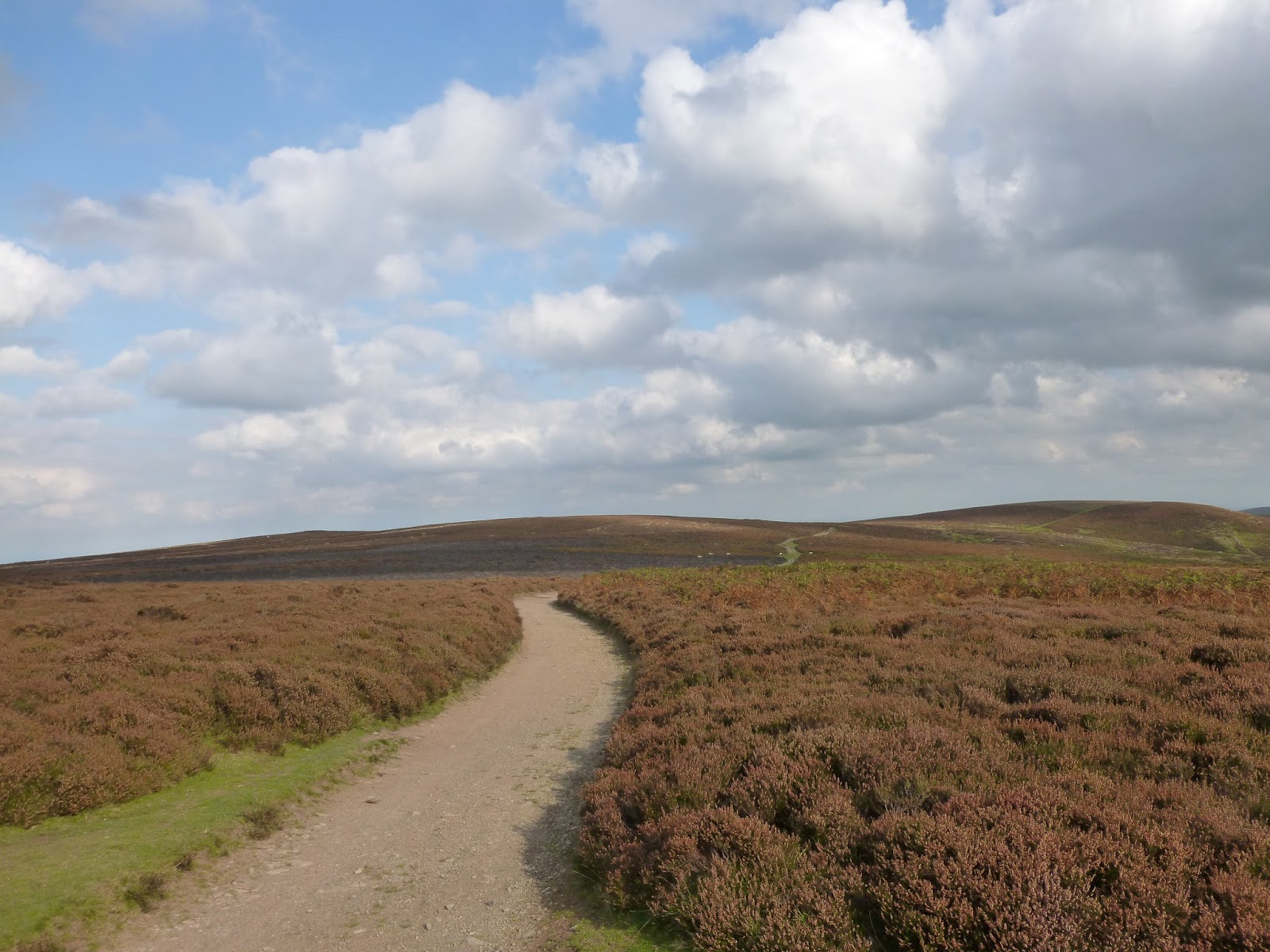
The Portway - a pre-historic track across the top of the Long Mynd
From the site of the old corrugated iron shooting box, which must have been gone for twenty or more years now, there were impressive views westwards on this lovely clear day. A couple of miles to the west is the lovely Stiperstones ridge, with its tors that make the Devil's Chair, and its unmissable sky line, and its ankle breaking quartz rock hidden in the heather that runs the length of its ridge. Further to the south and west is the easily recognised profile of Corndon Hill, still in Shropshire, but right up to the Welsh Border with old Montgomeryshire, killed off in 1974, resurrecting the Powys of old, but without its princes. And on the far horizon, the distinctive shape of Cader Idris, which must be forty miles as the crow flies, and the high mountains of southern Snowdonia.

Pole Bank - the top of the Long Mynd, looking towards the Stiperstones

Selfie at Pole Bank

From Pole Bank I back tracked a couple of hundred yards and then headed off down towards a spring called Boiling Well and the lovely little path down Ashes Hollow, winding through the autumnal bracken, following the stream around its perfectly interlocking spurs.  

Heading down Ashes Hollow

In Ashes Hollow
Right at the end of the hollow is a small but perfectly formed little camp site on the edge of the village of Little Stretton. I last camped here with my little brother when I was sixteen, in my first ever tent, a Litchfield Mistral 1. This served me well in my early forays in the hills, until its groundsheet lost all its waterproof coating four years later resulting in a damp night in an Alpine meadow. That was the day after Elvis Presley died. My memory is a strange and mysterious thing.
Wonderful location at Little Stretton, but rather over priced
It was somewhat fitting that I was back at the site where I tested out my first tent, as I could now try out my latest, my Z Packs Hexamid DuplexAlan Sloman has decreed that all tents should have a name, and that tents are female, so the Duplex is now Daphne.  At just 835 grams, with added linelocks, pegs, and in the 'heavier' grade cuben fibre option, she is ultra lightweight for a two person shelter, and she has some pretty radical design features. But I need to know how she will handle bad weather.  Rain should be no problem, but what about a good British hoolie?  She  certainly wouldn't have managed well tonight, though. I tried out a new set of Vargo titanium pegs, and four of the six bent badly and so she was not anchored down that effectively. What titanium is doing bending so easily I do not know, but I shall bring the Clam Cleat Tornadoes next time.


I'm getting my money back. Vargo Titanium V pegs after their first use. The four failures all occurred at the same point on the peg
Before bed, though, I wanted to indulge in some fine dining.  Sainsbury's packet tomato soup is really rather good. Mountain House dehydrated meals aren't.  I am still using up a stock from an ill advised purchase.  Perhaps the walk had been too short to make it edible, but it was in the bin after a couple of spoonfulls, the perfect excuse to walk a few hundred yards to the Ragleth Inn and a very good bar snack. Tempura prawns in chilli sauce, Steak Dianne, sticky toffee pudding and a couple of pints of 'Shropshire Lass' if you want to know, and an hour with the Kindle, before heading back to the tent.

I wasn't to find out this night how well Daphne copes with weather.  For much of the time it was still, and only in the early hours did the slightest breeze materialise.  I bedded down with the doors open on one side, admiring the stars and the moonlight.  For a single skin shelter I was impressed at how little condensation formed.  It was a calm, clear night and I was next to a stream. There was some, but she is super spacious and it was easy to stay away from the walls. There is none of that head in the sides nonsense of many other lightweight shelters, either when lying down or sitting up.
Z Packs Groupie: The Hexamid Duplex, aka 'Daphne' and the Arc Blast aka 'Billy'

Daphne can take two men at once. She is a palace for one

I had to get back home earlyish in the morning, so after my breakfast special of porridge made in a plastic bag I had a back jarring couple of miles by road to Church Stretton and the car home.  A fine little outing for me and the new girl.

Thursday, 6 March 2014

The Great Outdoors Challenge 2014: Training


Great Calva in the Northern Lakes on a recent training walk
The blogosphere and the TGO Challenge Message Board are both remarkably silent on how people train for the TGO Challenge, although Robin www.blogpackinglight.wordpress.com has put his head above the parapet and outlined his regime.


Hyperdog training at the Back o' Skiddaw


Bleak Skiddaw House on a recent wet training walk

From what I have gleaned, though, fitness preparations for the Challenge fall in to several categories, real or claimed by various Challengers:
  • Some walk so regularly in the hills that they retain their fitness and do not need to worry about it.
  • Some profess that their training amounts to no more than frequent trips to the pub followed by a stroll around the local park on the first Sunday in May.
  • Others seem to go on two or three longer trips come March and April.
  • And (the majority?) fit in what day walks they can around all their other commitments, often with a rucksack loaded with a few bricks or several tins of baked beans to add a bit of weight.

And I guess there are a number of variations and combinations on the above.

I fall into the latter category, although I will also soon be participating for the first time in the infamous April “daunder”, organised this year by veteran challenger and all round good egg Alan Sloman alansloman.blogspot.com which will be in the North Lakes.  I have a suspicion that this will be arranged in such a way that it will involve practicing all aspects of the Challenge ie it will involve bog, rain, scenery, hip flasks, cheese and the pub.


To digress slightly, readers of this blog with good memories may recall that I suffer from a condition my wife refers to as “Skod”.  For those of you without medical or psychiatric training I should explain that Skod is an acronym for  “Some Kind of Disorder”.  Symptoms are many, but  include rotating plates and crockery in the kitchen so it all gets used the same amount, and thus wears out evenly, along with ensuring mug handles point west and jug handles east when they are put away in the cupboard, and making lists. I have lists of everything.  So I have records of all the training walks I did for the 2013 Challenge which, I should say, were not very extensive.  Thus, I can tell you that between the end of November 2012 and the end of April 2013 I did 18 training walks, 9 of which were in April, averaging 15.67 km each in distance, and with an average height gained of 408.44 m.  Pack weights carried varied from 6kg to 13.7kg.  Look, I know this is tedious stuff, but please make allowances. I do have Skod you know.


For one reason or another I have done far less walking over the last 8 or 9 months than I would have liked. Thus, my fitness levels are lower than they have been for a long time, and before Christmas I decided that I should start to train for the 2014 TGO Challenge this May and that I needed to do more than last year.  However, the best made plans are paved with good intentions, as they say.  Or some such. There is nothing like a mixed metaphor.  Anyway, my training so far has been half hearted and I need to move it up a gear if the first few days of the Challenge are not to be a pain in the proverbials.  Proverbials, in my case, being my calf and thigh muscles which have been fecked, as Father Ted might say, since two major back operations played havoc with my sciatic nerve, and a more recent DVT did for the blood circulation in my thigh.

The old Greenside mine, now outdoor centres, above Glenridding


So recent weeks have seen me out and about. Not a lot, but I will be trying to do more.  I walk hyperdog two or three times a day but I don’t count that as training.  For me a walk becomes training once I put a pack on.

Catstycam on my walk up Red Tarn Beck: Hyperdog's first encounter with snow. He wasn't certain at first, then ate it like it might never fall again
  

I have had three 15km strolls along the lanes near the house, and covered shorter distances, but with more height and roughness involved, on a couple of 3 hour hikes on the Long Mynd in Shropshire, a very wet 3 hours Back o’ Skiddaw, another 3 hours by Red Tarn Beck on Helvellyn, and yesterday I was on the Berwyns in mid-Wales, when it was far colder and claggier than expected.  Hyperdog has been my companion on these walks, as the photographs testify. I haven’t yet had the heart to explain to him that his training is in vain and he will not be on the train to Scotland come May.

So apart from the weight on my back, neither distances or height climbed have yet been close to replicating those involved in a day on the Challenge.

Heading up Moel Sych in the Berwyns.


Llyn Lluncaws in the Berwyns


Neither of us were impressed with the boggy ground coming off Moel Sych


Heading down to Tan y Pistyll


Tan y Pistyll in the Berwyns

But the met men say that air pressure is rising and I hope to be up in the Lakes next week…..


Monday, 29 April 2013

Madness on the Mynd: A Walk In Shropshire


Retrospective View to Ragleth and Caer Caradoc
 I was fortunate enough to have the opportunity today to race off down to Church Stretton for a quick walk on the Long Mynd.  When I say “race” down to Church Stretton, I must hasten to add that this did not involve racing over the speed limit.  Oh no.  I’ve learnt my lesson.  Literally, from a very nice young man who ran the speed awareness course in Chester-le-Street on behalf of the Durham Constabulary.

So I raced down, always under the speed limit, and parked in the National Trust car park in Carding Mill Valley then set straight off on a very pleasant walk.  Well I have missed out certain details you do not need to know which happened between parking and setting off eg hurtling up to the gents’ for a pee as soon as I could.  I blame the pressure of the seat belt on my bladder whilst driving, although others, who shall not be named, ie my lovely wife just tells me that it’s a middle aged bloke thing.  I am currently considering writing a series of guide books to public toilets.  I am starting with Cumbria.  It will be a series of 7, which I shall call “A Pictorial Guide to Lakeland Lavatories".  I shall hand write the text, which will be accompanied by pen and ink sketches.  I reckon the format might catch on and inspire other guide book writers.

But there is another thing which you do need to know about.  I also didn’t start the walk before I had put on my boots, not being into bare foot walking.  I have been wearing trail shoes for the last few months, apart from when facing wintery conditions, but I have recently invested in some new boots and I wanted to try them out.  They are the Ecco Biom Mid Boots, in a fetching grey coloured yak leather, as reviewed and recommended by Robin at:


New Boots! Ecco Biom Mids


I did not need boots today, but a shortish walk seemed a good way of seeing whether they hurt the toes, ankles, knees and toes, knees and toes.  There's a song in that last phrase.  As it happens I was pretty impressed with them.  They seem a bit weird, as to look at they are three quarters rand and one quarter yak leather.  I shall call them my randy boots from now on.

Rather than walk down the road to Little Stretton, from where my route would take me on to the Long Mynd, I followed a path running slightly above the base of the Mynd, which was very pretty, but rather tortuous in places, eg because of the occasional obstruction such as a barbed wire topped  fence that had to be “negotiated”.  We never climb fences blocking our path do we?  Certainly not.  Never at all.

From Little Stretton the walk was Shropshire at its best.  A stiff breeze, sunny spells and fluffy clouds.  The views were extremely clear, and as I climbed there was a magnificent panorama to the rear of me to the hills on the other side of the Stretton fault line - Ragleth, Hope Bowdler and Caer Caradoc, ground I had covered a fortnight earlier, and also beyond to the Clee Hills.  For those of you who know the area, I took the path skirting round Callow Hill and Round Hill, a gradual climb to the moorland plateau that makes the Long Mynd.  Then it was on to Pole Cottage and the top at Pole Bank.  It was good to pass a small sign still pointing down the west side of the Mynd to “Priory Cottage” near Pole Cottage.  I have not been down there for years but this was once the run down outdoor centre owned by the then Priory Boys Grammar School in Shrewsbury where I received a pretty good education 40 years ago.

Looking towards Pole Cottage (in the trees)

 The views west from Pole Bank were at their best today, especially over to the splendid Stiperstones, the highest hill in Shropshire, with its quartz tors forming the Devil’s Chair and other landmarks, and to Corndon Hill.  Corndon is at the end of the “Six Shropshire Summits Walk”.  That is a 35 mile outing over the 6 hills in Shropshire over 1500 feet in height.  I have done that walk twice, but not since 1973.  The summit of Corndon is actually in Powys (or Montgomeryshire as it was when I was last up there) although its base is in Shropshire.  The walk goes over Brown Clee, Titerstone Clee, Wenlock Edge (not one of the 6), Caradoc, the Long Mynd, the Stiperstones and Corndon if you really want to know.  I seem to remember it took me 10 hours and 25 minutes the last time I did it, which is not bad going for 35 miles.

Pole Bank looking towards Corndon Hill


Now this post must be getting tedious to read so I will stop reminiscing and rant instead.  The amount of litter at Pole Bank was horrifying.  My guess is that it was from a single small party.  Pieces of tin foil blowing around –someone’s sandwich wrapping I assume, together with trail bar wrappers and the like.  I spent 5 minutes clearing this up.  I will now use some modest and mild words to describe the people who left this.  They are disgusting, selfish, self-centred lazy, dirty bastards.  And tossers to boot.  Why bother walking up to a place of incredible beauty if you are going to despoil it?  I can’t fathom it.  As I said, tossers.  Later on the walk I picked up an empty 1 litre plastic bottle (Asda Apple and Mango Sparkling water, with no added sugar) and brought that home too.  Out of curiosity I weighed this when I got back.  52 grammes.  Who can’t be arsed to carry 52 grammes off the hill with them?  When they carried it up, with its kilo of fizzy nastiness, it must have weighed 1kilo and 52 grammes.  As I said, tossers.
From the Mynd to the Stiperstones
"The Shooting Box" Sandwich Spot
 I didn’t let the behaviour of others spoil the walk.  It was delightful.  From Pole Bank I went down to the Shooting Box and ate my sandwiches.   The Shooting Box now is just a grassy mound.  When I were a lad there was a corrugated iron hut here, with a distinctive triangular profile.  A great navigational aid it was, in mist and clag, as it could be seen for miles.  After my lunch I followed the Jack Mytton Way before cutting down to follow the stream in the super V shaped valley that is Carding Mill.  The Jack Mytton Way was mentioned in a recent TGO route description. The author appeared not to be aware of Jack Mytton.  Well let me tell you.  He was mad.  Nutty as a fruit cake that definitely may contains nuts.  “Mad Jack” Mytton he was called.  I used to live just off Mytton Oak Road in Shrewsbury so I know all about him.  He lived in the Hall along this road back in the early 19th Century.  He allegedly used to fight his dogs with his teeth.  Mad Jack also once rode his horse up the stairs of Leamington Spa Town Hall, out on to the balcony then, still seated on the horse, leapt off.  He used to hunt ducks, in the middle of cold winter nights, whilst absolutely starkers.  So, as you can see, he was definitely a bit bonkers.  Check him out on Wikipedia if you have 5 minutes to spare.  They ought to make a film or write a novel about him (that idea is, from this moment, copyrighted by me).
Descending to Carding Mill Valley

Three and a half hours of perfection, in 12.5 km.
 

Tuesday, 30 October 2012

A walk on the Mynd - and a view to the Urals -honest!

Having gawped at my old haunts in the Shropshire Hills from the Berwyn Mountains (see previous blog) in mid-Wales a couple of weeks ago, I had the opportunity, and a good excuse, to get out on them last Tuesday.  I had the car booked in for a service in the dealers in Shrewsbury.  The garage being 20 miles from home, and having a few hours to kill, I went off in the courtesy car to Church Stretton, that unspoilt lovely large village, or a small town if you are an optimist, at the foot of the Long Mynd.  Stretton is well worth a mooch if you get the chance.

The weather was pretty dire. Mild - good. No wind - good. Clag, clag, clag, clag - not good. But after wandering round the fabulous antiques markety - shopy type thing, and after finding the most brilliantest cafe hidden down an alleyway, for coffee and cake, I headed off to the closest thing that the area has to a honeypot attraction, Carding Mill Valley, to park the car and start my walk.

If you don't know it, and you have children and you are in the area, Carding Mill Valley is the place to go. It's brilliant for children in wellies. A gentle mountain stream to splash about in; sheep; a ford to wade through; the Lightspout waterfall just up the valley; and a good National Trust tea shop. And it is the start of a range of walks in great countryside which can be made as gentle and short as you like or, as much as the geography will allow, as challenging as you could want with children.


Carding Mill Valley above the touristy bits

So I set off in the clag up this lovely V shaped valley, following the good path, towards the moorland plateau that makes the top of the Long Mynd. I stopped to watch a couple of parties of school students doing fieldwork, measuring the stream and valley sides. Which took me back a bit to my very distant days as a geography student and to my almost as distant days as a geography teacher.  One of the most memorable fieldwork sessions I ever led, in about 1981 I think, saw one of my O level students, Alison Hall, disappear backwards into a five foot pot hole in the stream bed on a bitterly cold Easter day.  Oh how we all laughed, including Alison herself, who took the mishap in excellent heart.  These days I suspect the responsible teacher would have ended up with a writ for damages at worst; and a thump from an angry father at best.  And possibly both.

After just 40 minutes of gentle climbing I reached the top of the valley and emerged onto the plateau; 5 minutes later I reached the ancient Portway, a pre-historic track that runs across the top.


I photographed these sheep on the summit plateau as I couldn't see anything else

Following the Portway for 25 minutes saw me at Pole Bank, the summit of the Long Mynd. 516m above seal level if you are interested. The "seal level" bit in that last sentence was a typo, but I actually rather like it as a descriptor, so I am going to leave it in rather than correct it. Indeed, from now on " above seal level" will be my wording of choice when referring to the heights of mountains and hills. So much more poetic and accurate too.  The clag was even thicker on the summit, and there was nothing to see except the trig point. The views from here can be superb. On a clear day to the north you can see across the Shropshire - Cheshire Plain, right to the Pennines in Lancashire; the whole of mid-Wales is also on view, beyond the Stiperstones and Corndon Hill, as far as Cader Idris on a good day. Cader must be 40 miles away.  One day I  may blog about a walk up Cader I did at the age of 13 led, if I remember correctly, by one Chris Woodhead, who later became the notorious Chief Inspector of Schools, and scourge of teachers across the land.  Chris taught me at the Priory in Shrewsbury when he was a young and trendy English teacher.  That trip wouldn't have passed today's Health and Safety regimes either!  And to the east?   Well beyond the Shropshire Hills of Caradoc, Ragleth, Lawley, Wenlock Edge, the Wrekin and the Clee Hills you can, I have often been told, see the Urals in Russia.


Pole Bank, the top of the Long Mynd - not a seal in sight, for they are 516m lower down.  Of course they could be hiding in the heather.

Now there is the tiniest bit of poetic licence in this claim. But apparantly if you travel east from the Long Mynd there is no higher ground until you reach the Urals as you pass over the English Midlands, Eastern England, the North Sea and the North European Plain. So if it wasn't for the curvature of the earth, and weak eye sight, you could indeed see the Urals from this lovely little summit in Shropshire. And as a Salopian I am sticking to that story whatever anyone tells me. It's one to bore the kids with after they have walked up to the top. And goodness knows, I bored my two boys with that tale often enough when they were little.


Trying to spot the Urals through the clag at Pole Bank

The return was even quicker. I went down by the same route, although there are so many possible variations, the east side of the Mynd being bisected by a number of delightfully pretty valleys, separated by broad, heather and winberry covered ridges.  But today I had to get back to pick up the car and this was enough for me.  What better way to spend a couple of hours in the fog and drizzle if some fresh air is needed?  None that I can think of.  If you haven't visited Church Stretton and the surrounding area of South Shropshire do so.  You will not have any epics, but will not be disappointed.